


Resume
[Body of Work]
Resume
[Body of Work]
Professional Profile
Versatile, results-driven, and accomplished Geospatial Technology Specialist with extensive experience and expertise across all forms of project management. Assumes an organized and data-analytical approach to ensure both stakeholder and contractual satisfaction. Commended as a diligent and encouraging leader capable of training and developing colleagues to enhance value from project conception to completion. Possesses excellent communication skills that enables confident engagement with colleagues and stakeholders across all levels of business. Boasts a proven track record in developing and implementing innovative products that consistently meet prominent time, quality, and budgetary requirements. Able to conceptualize and think laterally, while introducing innovative ideas to continually enhance productivity and efficiency. Proficient in utilizing market and competitive research and evaluation to inform future decision making. Experienced in working and excelling alongside industry-leading professionals. Thrives in fast-paced scenarios while remaining flexible and adaptable in ever-evolving environments. Vastly knowledgeable in relevant programming languages and IT software. Always seeking to learn and apply new skills and procedures.
Career Summary
2010-2012 - PASCO SHERIFF’S OFFICE, New Port Richey, FL2011-2012 - GIS Intelligence Analyst
Liaised with colleagues and public to assist in the prevention and reduction of crime while successfully sourced, analyzed and disseminated information
Was responsible for advancing the agency’s geospatial capabilities as well as acted as the geospatial liaison to the Emergency Operation plan and as a representative on the Regional Domestic Security Task Force (RDSTF)
Key Achievements
Acted as the lead GIS Intelligence Analyst for the agency and thus was personally accountable for the development of new methods for targeting possible crime areas and preventing the evolution of crime
Utilized a number of technical and statistical tools including criminal/traffic data analysis to identify criminal patterns and crime/intelligence data analysis for law enforcement operations
Maintained and managed Spatial Intelligence Databases for interdepartmental purposes as well as implemented online statistical activity summary for use across the agency
Established the agency’s social media outlets for 45 individual School Resource Officers to assist in the dissemination of valuable information about crimes and crime prevention to students and parents
Performed spatial analysis of weekly activity for the creation of intelligence briefs
Crafted and managed the social media intelligence material for several divisions
Directed the operations of assorted criminal geographic databases for departmental use and created products requiring geographic representation
Provided crucial assistance in the natural disaster response during Tropical Storm Debbie as the Sherriff’s Office geographic liaison for the Emergency Operations Plan
Assisted in the geographic threat assessments for the 2012 Republican National Convention held in Tampa, FL as the intelligence representative at the local RDSTF
Managed vehicle tracking using AVL and developed/tested methods for expanding the use of the AVL to areas outside of vehicle tracking
Made a significant contribution to the location of missing persons as well as engaged in multiple cold case files in an effort to establish geographic connections
2010-2011 - GIS Analyst
Formed the agency’s geospatial needs by establishing GIS Best Practices and procedures to improve and standardize current processes
Spearheaded the expansion of the intelligence gathering capabilities throughout the agency as well as contributing to the development of strategic areas for crime reduction
Key Achievements
Turned around the daily and weekly pin map process by developing and expanding the use of ESRI ArcGIS across the agency
Managed and maintained GIS Databases files and data, while monitoring new crime trends throughout the county and communicating results
Worked closely with executive staff to ensure the efficient and effective use of assets as well as engaged in the procurement of funding from the State Legislature for additional deputies and equipment
Was directly responsible for researching patrol patterns and lead the establishment of Direct Patrol zones within the county and participated in monthly reevaluation and improvement
Was acknowledged for the excellence of work by receiving a letter of commendation from the Sheriff
2009-2010 - TAMPA BAY WATER, Clearwater, FL - GIS Intern
Contributed to the company’s mission for clean and safer water within the Tampa Bay region by cooperating with department’s project planning professionals and third party partners
Assisted in the acquisition, editing and managing of field collected data into existing databases, digitizing paper maps and engineering documents, and ensuring proper location in associated well field
Key Achievements
Gathered GPS data of field inventory in coverage areas and oversaw GIS Databases to perform file and data maintenance
Produced CAD documents for the purposes of new CAD guidelines creation and updated facilities maps for inter-office use
Located and marked underground pipeline access using photogrammetric methods
Education and Qualifications
Master of Science: Geographic Information Science & Technology
2014, University of Southern California, Los Angeles, CA
Graduate Certificate: Geospatial Intelligence
2010, Penn State University, University Park, PA
Bachelor of Arts: Geography
2009, University of South Florida, Tampa, FL
Associate of Arts: Liberal Arts
2006, Hillsborough Community College, Tampa, FL
High School Diploma
1999, Tampa Catholic High School, Tampa, FL
Certifications and Memberships
FEMA IS-230, IS-100, IS-700, USIP Conflict Analysis, PCII, A+
Member of the United States Geospatial Intelligence Foundation
Key IT Skills
Applications:
ArcGIS 10.x Suite, ArcGIS 9.x Suite, ArcServer and ArcGIS REST API, Trimble TerraSync, ENVY 4.7, ERDAS Image Analysis, LP360, AutoDesk AutoCAD 2006, 2008 and 2010, Microsoft Office Suite, HTML 5, JavaScript, CSS, Python, SQL, Microsoft SQL 2008, IDRISI Selva and Taiga, Google Maps API, LG Mobile, Analyst Notebook, Adobe Creative Suite, QGIS, GRASS GIS, RFFlow, SPSS
Hardware:
Trimble Nomad, Trimble GeoXH, Trimble Juno, Garmin GPS
Personal Details
Languages:
Spanish (fluent)
Other:
Qualified in First Aid; NAUI Advanced Certified SCUBA Diver
REFERENCES ARE AVAILABLE ON REQUEST
The University of South Florida
[The University of South Florida]
The University of South Florida
[The University of South Florida]
Background
Dates of Attendance: August 2006 - August 2009
Location: Tampa, FL
Degree: Bachelor of Arts
Major: Geography
GPA: 3.0

Program Information
Geography is a diverse and intellectually vibrant academic division of the School of Geosciences committed to excellence in geographic research, scholarship, and student success. The aim to produce outstanding students and to engage them in critical thinking, practical problem-solving, and meaningful research to serve the region and local community. A BA in Geography offers a broad education in human and environmental geography, which, combined with undergraduate research and practical knowledge, provides the necessary experience for a range of academic pursuits and employment opportunities.
The program focuses on three themes:
- Human geography studies the construction of space, place, and power. It encompasses the study of economic geographies (e.g., globalization and development), political geographies (e.g., geopolitical struggles and new social movements), and social and cultural geographies (e.g., identities and exclusions). Human geography is key to providing insights into contemporary spatial arrangements, including the role of cities within the global economy, locating urban-rural intersections in the production of uneven development, and how class, gender, and race shape struggles for social justice.
- Environmental geography links the study of nature and society and considers the ways in which conventional divisions between human and non-human (natural) worlds are bridged through the production of socio-natures. This understanding is crucial to explaining and ameliorating contemporary environmental problems, including the privatization of natural resources, inequalities in access to food and water, injustices associated with environmental hazards and undesirable land uses, and the role of human activities in spurring large-scale environmental change.
- GIScience and Spatial Analysis concentrates on the use of advanced geospatial technologies, and the development and use of spatial analysis methodologies, to applied research problems in human and environmental geography. A thorough understanding of such geospatial technologies as Remote Sensing, GIS, and GPS, as well as modern methods of spatial statistical analysis, and emerging spatial analytical techniques such as agent-based modeling, is a critical aspect of developing appropriate approaches to the analysis of geographic data.
Completed Courses
Coming Soon!
Coursework Portfolio
Coming Soon!
Penn State University
[Penn State University]
Penn State University
[Penn State University]
Background
Dates of Attendance: September 2009--December 2010
Location: World Campus (Online)
Degree: Graduate Certificate
Concentration: Geospatial Intelligence (GEOINT)
GPA: 3.75

Check back soon for the rest of the story!
The University of Southern California
[The University of Southern California]
The University of Southern California
[The University of Southern California]
Background
Dates of Attendance: September 2012 - December 2014
Location: Los Angeles, CA
Degree: Master of Science
Major: Geographic Information Science and Technology (GIST)
GPA: 3.66

Program Information
The Geographic Information Science and Technology online graduate programs serve as an academic pathway for students who are motivated to address major global challenges and make future technological breakthroughs via geospatial technologies. The Master of Science in Geographic Information Science and Technology and the graduate certifications in GIST, Geospatial Intelligence and Geospatial Leadership support a multitude of backgrounds, occupations and applications that rely on geospatial technologies.
The graduate programs’ curricula focuses on learning the various ways in which place or space (i.e., location or geography) are used to acquire, represent, organize, analyze, model and visualize information. We’ve designed the coursework rigorously, but the ultimate benefit to you is a more expansive, professionally relevant knowledge of geographic information science. During the programs, students examine the cyclical relationship between fundamental geographic information science, GIS technology and scientific discovery.
Completed Courses
To fulfill the requirements to obtain the Master's of Science in Geographic Information Science and Technology, I successfully completed 28-credit hours of 500-level courses achieving a 3.65 GPA. The courses were designed to be rigorous in theory as well as in practice by using the latest software along with the most cutting edge hardware. Ultimately, this approach fosters an expansive and professionally relevant knowledge base in geographic information science.
- GPS/GIS Field Techniques
- Web GIS
- Spatial Analysis and Modeling
- Remote Sensing for GIS
- Spatial Databases
- Master's Thesis


Coursework Portfolio
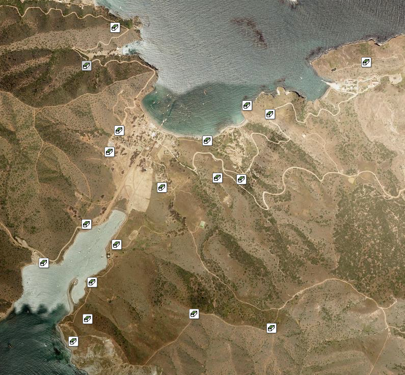
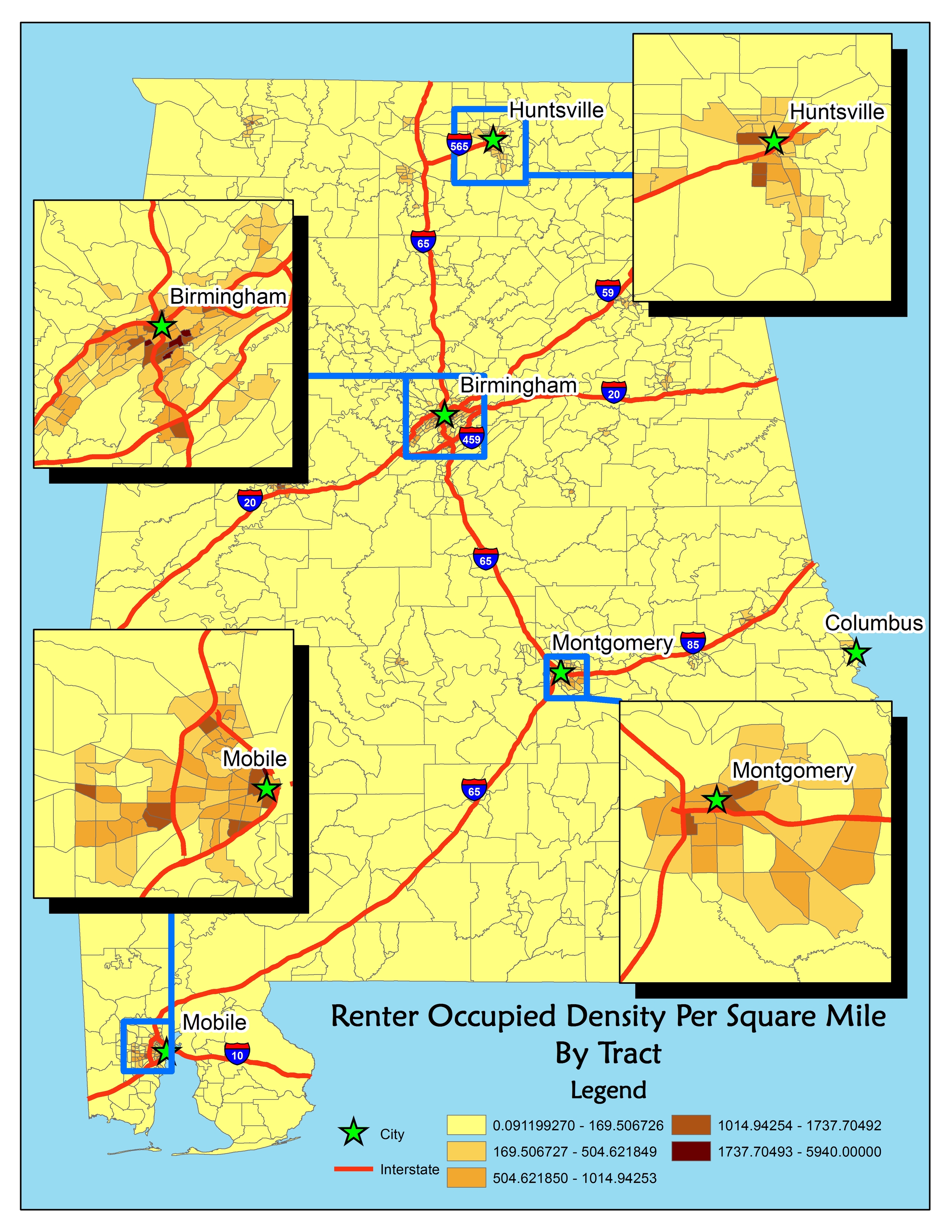
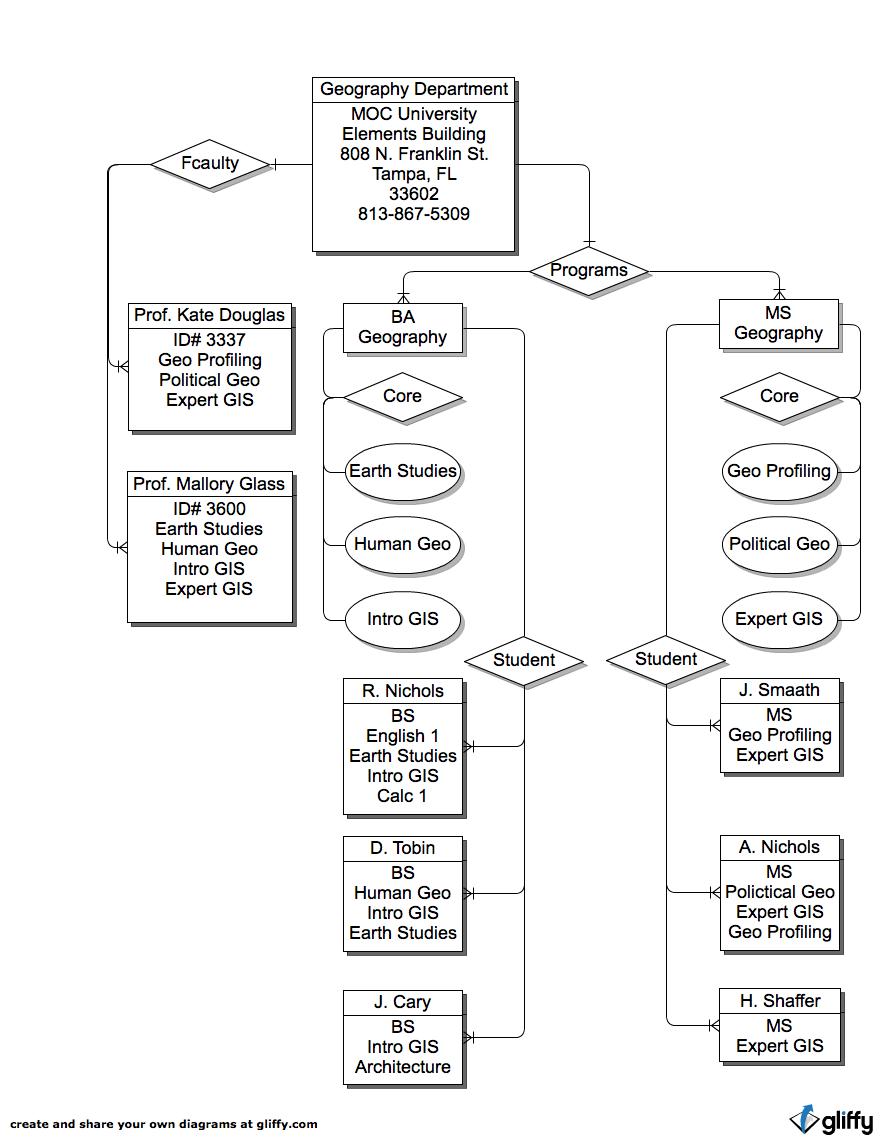
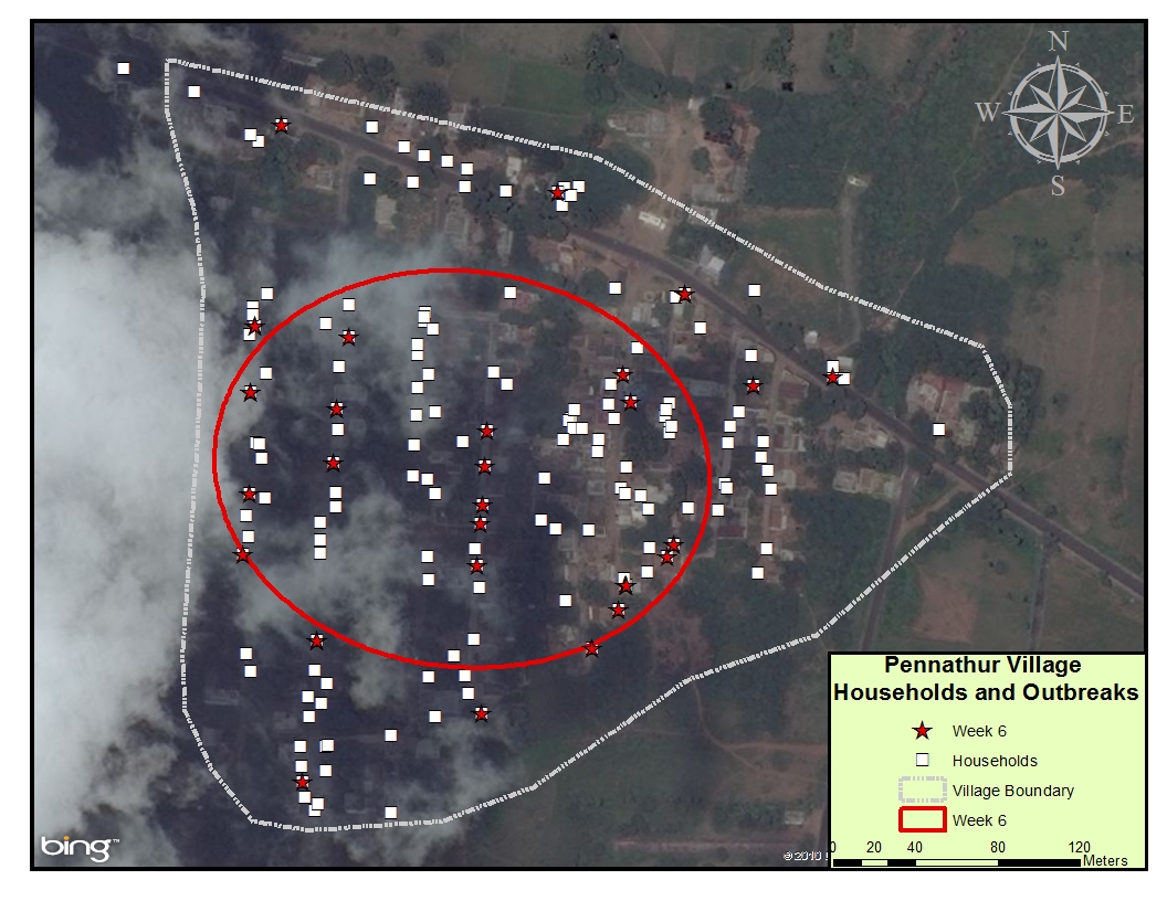
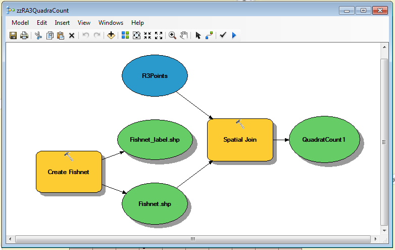
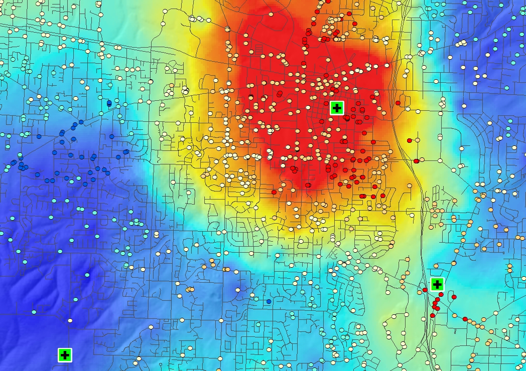
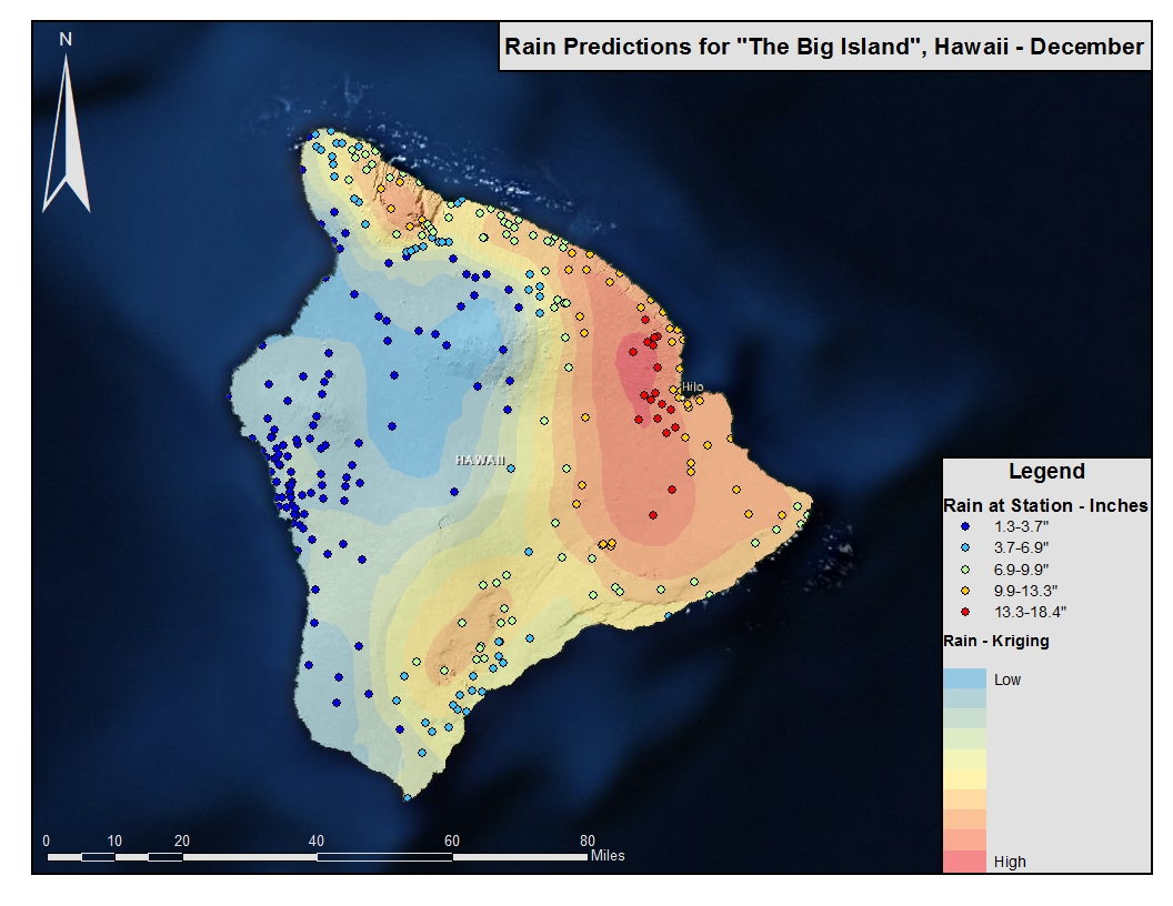
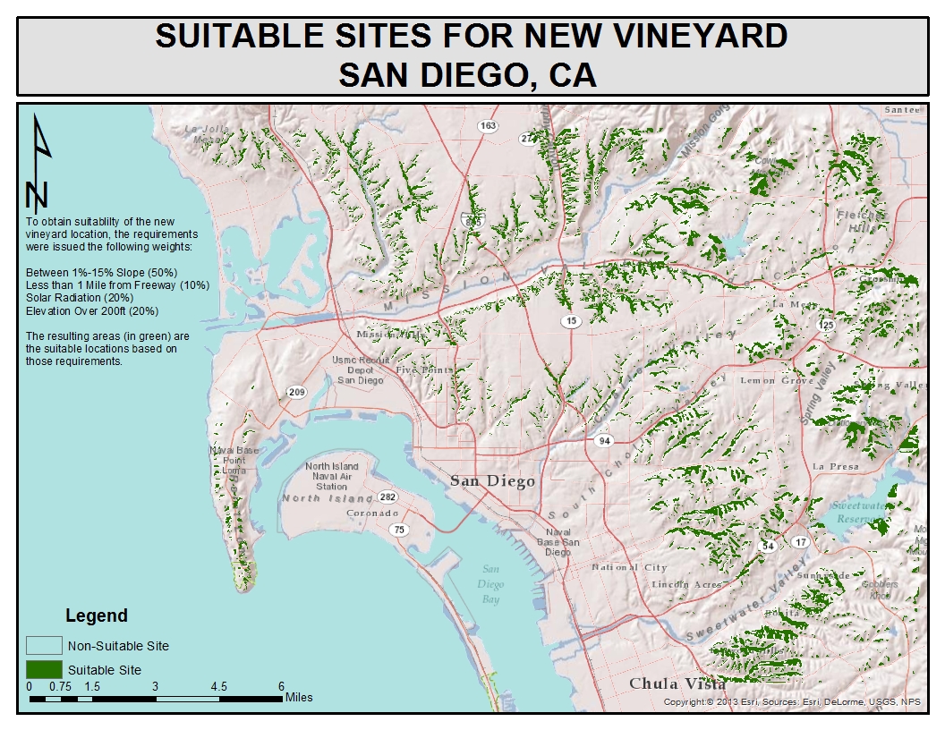
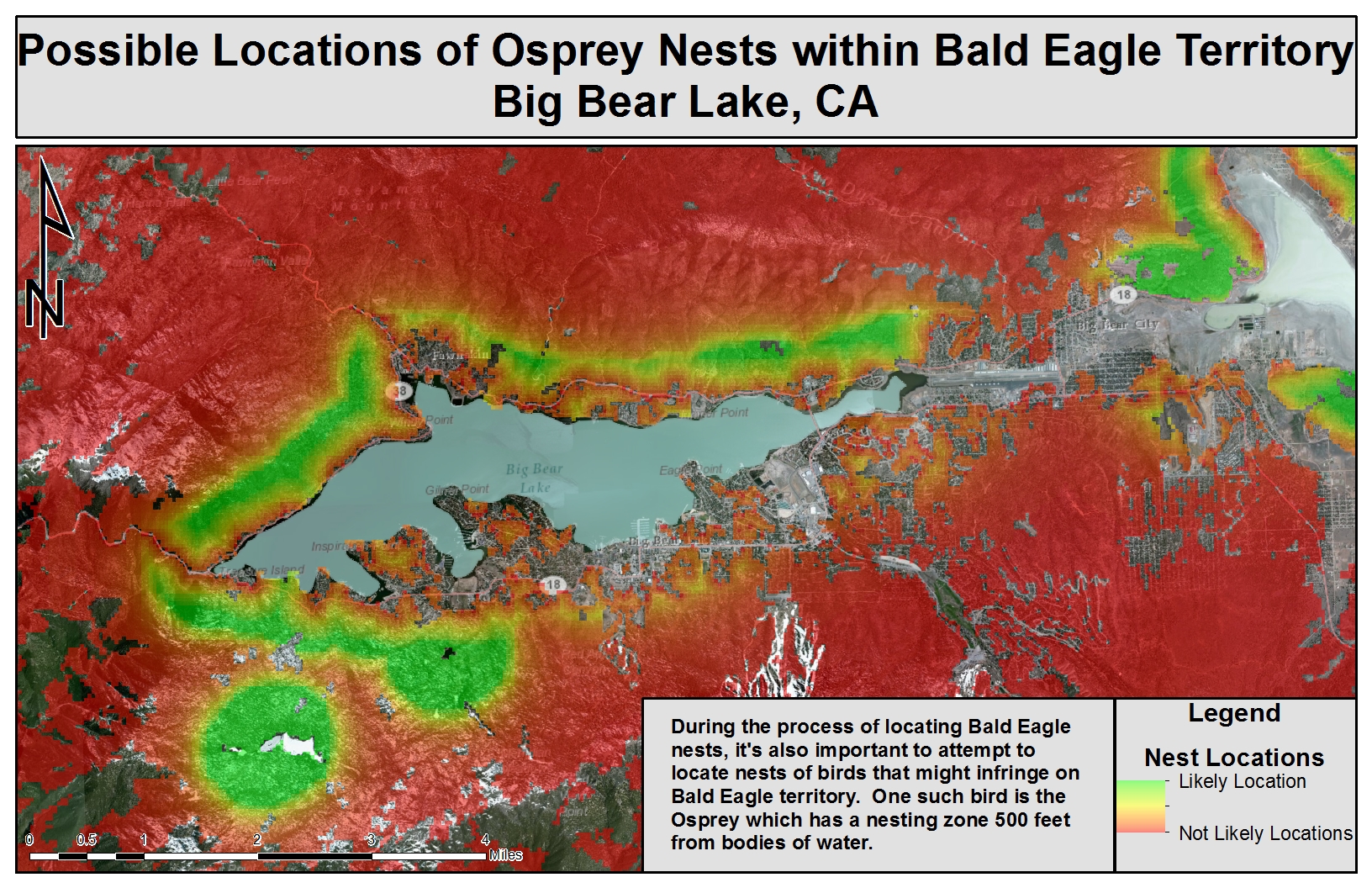
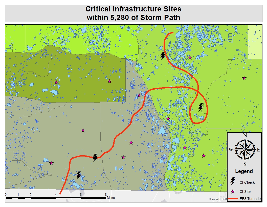
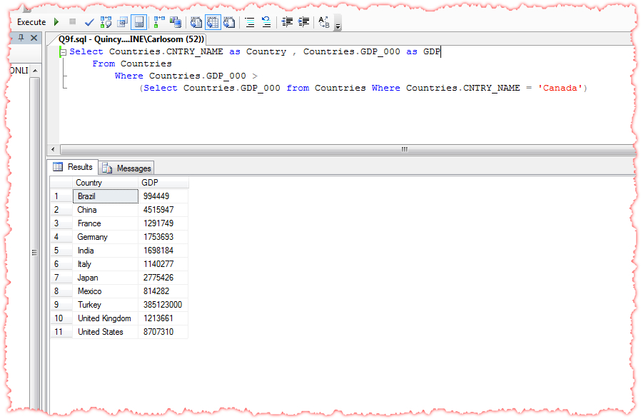
The images shown below are examples of work completed during the various courses of the program.
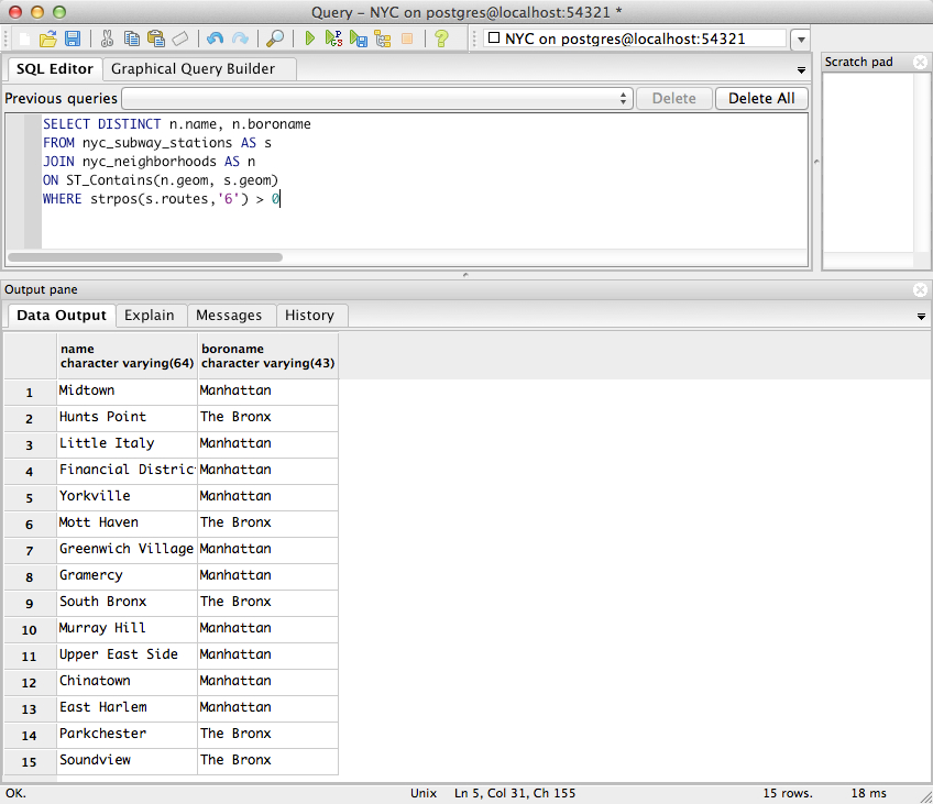
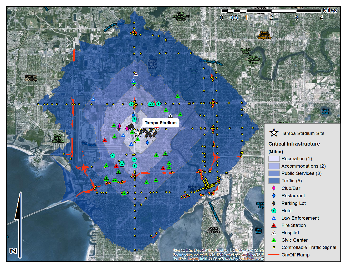
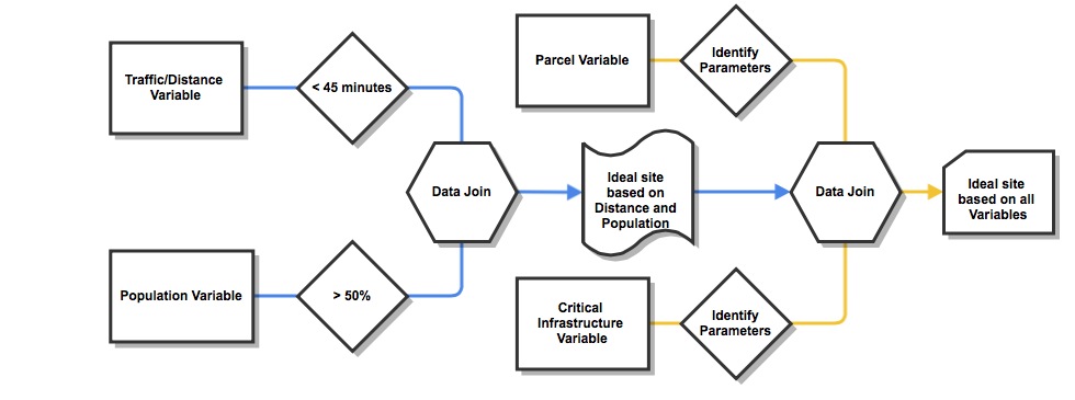
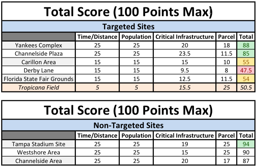
Thesis
As a requirement for graduation from the MSGIST program, I had to complete a thesis that pertained to filling a geospatial research gap. The topic that I chose was something that I found to be personally interesting to me and could have real world implications if the research proved beneficial. The thesis focused on identifying a suitable relocation site for the Tampa Bay Rays. The thesis--titled Relocation Bay: Identifying a Suitable Site for the Tampa Bay Rays--was easily the most complex and difficult 'thing' that I've ever undertaken. It consumed my life for almost an entire year and, in the end, the document was over 90 pages and over 18,000 words. Regardless of all that, it's something that I am very proud of and I consider it some of my finest academic work.